|
KNMI for the Caribbean Netherlands
Volcanoes in the Dutch Caribbean
The Lesser Antilles.
The islands of Saba and St. Eustatius in the Caribbean Netherlands are part of the Lesser Antilles volcanic arc.
The subduction of the North and South American plates underneath the Caribbean plate is responsible for the formation of magmatic material which erupts from the seventeen volcanoes forming these islands.
As the subduction is an ongoing process, the volcanoes of the chain can be supplied with new magma at any moment in time.
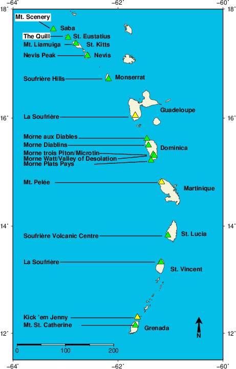
The active arc of the Lesser Antilles showing the islands of Saba and St. Eustatius in the far north, as well as the other islands of the chain. The triangles depict the location of an active volcano, and their names shown on the left. Mnt. Scenery and The Quill are highlighted. The color of the triangle depicts the state of the volcano as of 5 Jan 2021 whereby green=normal, yellow=advisory and orange=watch, see alert level for further explanation. For more information on the activity of other Carribean volcanoes see http://uwiseismic.com/ and http://nemo.gov.vc/nemo/index.php/home/welcome for Grenada, Grenadines, St. Vincent, St. Lucia, Dominica, St. Kitts and Nevis, https://www.ipgp.fr/fr/ovsm/lobservatoire-volcanologique-sismologique-de-martinique-ovsm-ipgp for Martinique, https://www.ipgp.fr/fr/ovsg/actualites-ovsg for Guadeloupe and http://www.mvo.ms/ for Montserrat. |
|
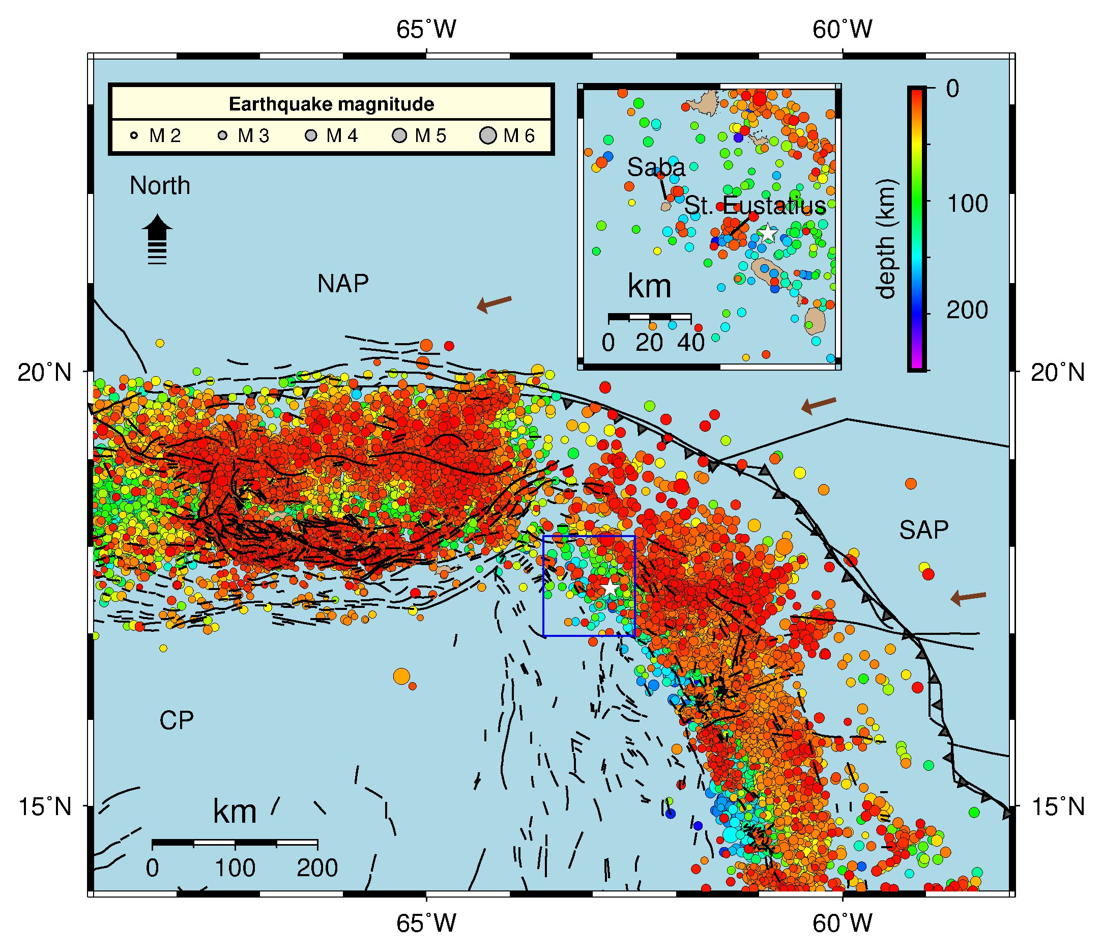
Epicentres and depths of earthquakes (M 2.0–6.1) in the region around Saba and St. Eustatius between 1 January 2010 and 15 March 2018 (data from ISC). Plate boundaries for the North American plate (NAP), South American plate (SAP) and the Caribbean plate (CP) are taken from Bird (see Geosciences Article). Tectonic faults are indicated in black. The brown arrows represent the motion of about 20 mm per year of the NAP relative to the CP. The blue rectangle on the map is enlarged on top |
|
|

|